Pacific Isle Mapping explores the fascinating history of navigating and mapping the Pacific Ocean, contrasting European maritime records with the ingenious indigenous navigation techniques of Pacific Islanders. It argues that the mapping of the Pacific was not solely a European endeavor but was significantly shaped by the existing knowledge and navigational systems of Pacific peoples. The book challenges Eurocentric narratives by illuminating the sophisticated methods used by Pacific Islanders, such as star compasses and wave pattern interpretation, passed down through generations.
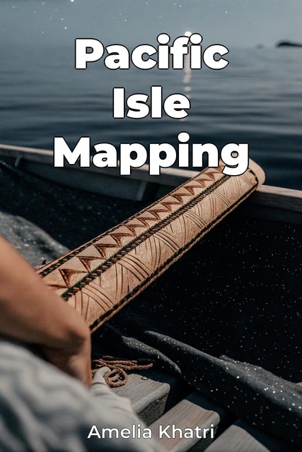
The book progresses by first establishing the historical context of European exploration, then transitioning to an in-depth examination of indigenous navigation techniques. A key focus is comparing European charts with indigenous conceptualizations of space, such as the stick charts of the Marshall Islands, highlighting their unique approaches to maritime records. By integrating both perspectives, the book provides a comprehensive re-evaluation of Pacific history, acknowledging the active role Pacific Islanders played in shaping the world's understanding of their region.